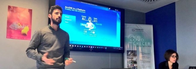
@ESRI_SPAIN WORKSHOP ABOUT #BIGDATA , #ARCGIS #ML AND MUCH MORE
Mar 14
- posted by Geotech Master
- in Sin categoría
- 0 Comments
From February 21th to 22th, at Jaume I University – Castellon de la Plana (Spain) a set of courses were held by Esri Spain. Workshop’s main topics were about detecting spatial patterns, analyzing big data and applying ML with ArcGIS platform.
During two days over 20 students – from the Geo-C project and Mastergeotech students – attended the lectures given by Alberto Céspedes and Dariya Ordanovich from Esri Spain. By the presentation of several examples, Alberto and Dariya explained how concepts like Machine Learning, Spatial Big Data and Spatial Patterns fit into ArcGIS.
Initially, Alberto Céspedes taught how to use Insights for ArcGIS creating easy-to-use dashboards which integrates spatial and tabular data for contextual analysis. Insights for ArcGIS is a web-based tool for data analytics that delivers an integrated view of the results, including charts, graphs, and maps.
The applicability of machine learning algorithms using ArcGIS tools was also presented during these workshops by the application of image detection for an extensive amount of satellite images. Geo-analytics tools from ArcGIS Pro provides a better understanding of an enormous amount of spatial data, integrating data web services with spatial geoprocessing tools.
Finally, Dariya Ordanovich illustrated how to connect, install and use R with ArcGIS, making use of the R-Bridge for ArcGIS. This open source project allows R users to work with ArcGIS data, and ArcGIS users to leverage the analysis capabilities of R.
For more information, about the tools used during this workshop, visit
https://www.esri.com/en-us/arcgis/products/insights-for-arcgis/overview
https://r-arcgis.github.io/

